
Autodesk InfraWorks
Bring Your Infrastructure Designs to Life in 3D
Autodesk InfraWorks Allows You To Plan, Design, and Visualize with Confidence
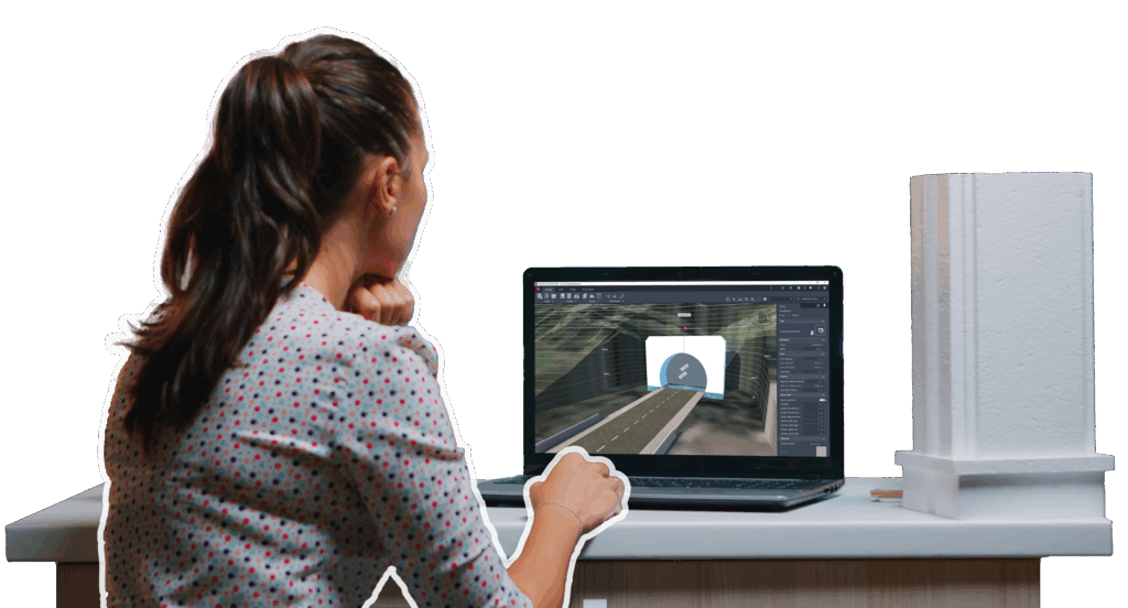
Autodesk InfraWorks transforms how civil engineers and planners conceptualize infrastructure projects. It combines powerful 3D modeling, data integration, and real-world visualization tools to help you design and present projects that are accurate, contextual, and ready for approval.
Whether you’re planning a new highway, developing a bridge network, or designing urban infrastructure, InfraWorks helps you evaluate alternatives early in the process and communicate design intent clearly to stakeholders and clients.
Why Engineers Choose InfraWorks + KETIV
Autodesk InfraWorks is trusted by civil design teams who need to evaluate alternatives, communicate clearly, and deliver projects efficiently. By integrating GIS, survey, and BIM data into one dynamic 3D model, InfraWorks helps you visualize how each design concept decision affects the landscape, budget, and project feasibility.
With InfraWorks and KETIV, you can:
- Combine terrain, roadway, and structural data in a single 3D model for accurate visualization.
- Generate and compare design alternatives quickly during planning and proposal stages.
- Build high-impact presentations for public meetings or stakeholder approvals.
- Collaborate through the Autodesk Industry Cloud with Civil 3D, Revit, and Navisworks users.
- Get expert onboarding, training, and support from KETIV to integrate InfraWorks seamlessly into your workflows.
KETIV customers have achieved measurable time savings in early-stage design by integrating InfraWorks with Civil 3D and Autodesk’s connected data workflows.
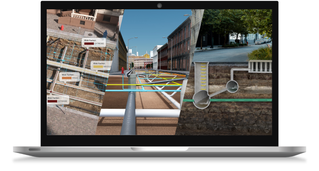
Real-World Use Cases
Transportation Projects
Designers use InfraWorks to import GIS and survey data, create multiple highway alignment options, and evaluate traffic and environmental impacts, reducing early-stage design time by up to 35%.
Urban Development
Municipalities and private developers rely on InfraWorks to model terrain, utilities, and building massing, then present photorealistic 3D visuals to city councils and stakeholders for approval.
Land & Water Projects
Civil engineers plan grading, drainage, and bridge crossings with data-rich models that reveal conflicts early, before detailed design in Civil 3D or Revit begins.
Each example highlights InfraWorks’ true power: connecting design intent with communication and collaboration for better outcomes.
Why Partner with KETIV for Autodesk InfraWorks
KETIV is an Autodesk Gold Partner dedicated to empowering engineering and infrastructure teams to design smarter and deliver faster. We don’t just sell software, we help you implement it effectively to achieve measurable results.
- Tailored Implementation: Align InfraWorks setup with your existing project standards and workflows.
- Training and Virtual Academy Access: Learn from certified Autodesk experts through live or on-demand sessions.
- Connected Workflow Integration: Link InfraWorks with Civil 3D, Fusion, Navisworks, and Revit for complete data continuity.
- Ongoing Support: Receive guidance, troubleshooting, and optimization for every phase of your project.